

Demystifying the Dolomites
- Nemisha Singh
- Jun 6, 2022
- 16 min read
Updated: Aug 7, 2022
Your complete guide on exploring the gems of the great Dolomites


Over many years, I have been reading about how spectacular the Dolomites are. My bucket list for the Dolomites consisted of some of the most iconic spots that kept re-appearing on the internet. I found those pictures simply incomparable. Hence, it was high time that I personally made a tour of these mountain ranges in northeastern Italy. Finally after having covered those spots on my 11 day itinerary, I created this post summarising the most famous places of the great Dolomites that deserve once-in-a-lifetime visit - your ultimate Dolomites guide.
Going to the nature is like going home.
To avoid the crowds, I travelled off-season which were 11 days in May (please note that including arrival/departure time would make it 13 days in total). Over the course of this trip, I stayed in 4 different towns from where I visited the planned places of interest. In the table of contents below, I have categorised each attraction under the town of accommodation.
NOTE: Each location listed in this guide is also marked in a map. You can save these locations to your phone and use it for navigation during your trip.
So, please grab some coffee and let's get started !

In This Guide
1 - St. Maddalena
Why visit the Dolomites


I mean why not ? Look at these fairytale-like images. Where else would you find them ? The Dolomites are a mountain range in the northern Italian alps spanning the regions of Veneto, South Tyrol and Friuli Venezia Giulia. Here, you will find epic mountains, scenic passes, picturesque alpine lakes, panoramic hiking trails, lush alpine pastures, mountain huts and a myriad of charming villages. The views in the Dolomites are one of the best that you can enjoy in entire Italy. And the available mountain trails are a hiker's dream. Of course, you can undertake other summer activities like trail running, rock climbing, paragliding and mountain biking. I assure you will definitely fall in love with this place. The highest elevation of the Dolomites is Marmolada at 3,342 m.
Easiest way to get to the Dolomites
I highly recommend you to make your trip to the Dolomites by a car or rent one if you do not own a car in Europe. A car is the fastest and easiest way to discover the Dolomites. You can arrive in the Dolomites region by car via the Brenner Highway (A22). Please note that there are toll booths on the Brenner Highway. So, whenever you enter the Brenner Highway, you will receive a toll ticket which you will have to pay at another toll-booth as soon as you exit the highway. There are many mountain passes for road lovers that offer great views over the ever changing colours of the Dolomites. In certain protected areas of the Dolomites, vehicles are forbidden for few hours during the day. So, if you are not very keen on hiking steep trails, then a range of mountain lifts are available in the summer season that will easily get you to higher altitudes. Parking lots are available everywhere, even near mountain lift stations. However, if you want a hassle-free parking, then make sure you arrive early at the spot.
Best time to visit the Dolomites
The best period to visit the Dolomites is from late May till early October. If you want to avoid the crowds (like me), then late May or early October are most suitable. However, please note that certain mountain lifts start operating only starting June. Also some hiking trails may be inaccessible in May due to presence of snow. So, when you visit off-season, then you can only reach certain locations on foot. If you do not want to miss out on any location and would like a limited touristic presence, then June and September are the best months for you. The months July and August are very touristy since they are the warmest.
Things to carry in your backpack
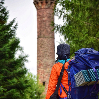
Many famous places in the Dolomites are easily accessible by car. However, there are certain spots which are neither accessible by car nor by a mountain lift. In this case, your only option is to hike. Hiking can be strenuous and you do not want to miss out on important views. Make sure you go out with weather-resistant sports-wear and have sturdy hiking boots. Do not underrate the hiking poles. They help a lot when the trails are steep and pebbly. Your backpack should include protein snacks, water, camera, tripod, phone, navigation equipment (I used offline maps on my phone), power bank, sun-glasses, flashlight, wallet, raincoat and some items for personal hygiene. For long hikes, a first-aid kit is also recommended. I additionally carry dress(s) that I wear for my photoshoots since I am not always keen on taking pictures when I am sweaty after a strenuous hike.
Iconic places in the Dolomites
There are many beautiful places in the Dolomites. I remember getting tired figuring out what to visit and what not. If you just drive around in this region, you will notice that each corner, each village/town has to offer something special. But of course everyone has limited time. You cannot stop everywhere and capture all places. Since I don't want it to be too overwhelming for you, I have prepared a list of must-see-places that you can include in your itinerary. Remember you will find each location also tagged in a map.
1. St. Maddalena
Throughout my trip, I booked apartments that had a kitchenette. I didn't want to be so lavish and cooked my meals at the apartments I booked in order to stay within the limits of my planned budget. My first accommodation was in the postcard town of Santa Maddalena. If you search for Dolomites in the internet, one of the most frequent picture that would pop-up is that of Santa Maddalena. This town is simply bewitching and is located in the enchanting valley of Val di Funes. For the 3-night stay, I planned to visit the Santa Maddalena church, the Saint Giovanni Church, the lake of Braies, the mountain hut Geisler Alm and the lake of Landro.
St. Maddalena Church

The first spot in my list was the Santa Maddalena church. It was a very easy hike to the view point. The scene with St. Maddalena church right in the centre and the Geisler peaks (also known as the Odle peaks) in the background was jaw-dropping. I had never witnessed such a scenery before. It took some time for me to realise it wasn't a dream. According to a legend, after a heavy storm washed ashore a small statue of St. Magdalena, they built a church exactly on that spot. My first day in the Dolomites was little cloudy which is exactly what I wanted. After arriving at the view point, I waited for the clouds to cast some shadow on the fields. This made my pictures stunning. When I reflect on that day, the view felt right outta dream !
Photo location on map
St. Giovanni Chapel

On foot, the St. Giovanni Chapel is only a 40 minutes easy walk from the view point of St. Maddalena church. This chapel is built on a private property called as the Ranuihof which in turn is located in the St. Maddalena town. You may enter the chapel property and take a tour inside the church by paying a small fees. This area is a no-fly zone. However, many photo points have been erected at the boundaries of the church from where you can take stunning pictures of the scenery. For my motif, I chose a location faraway from the property which you will also find in my map below. Surreal meadows, a 17th century church and the Geisler Peaks of the Puez-Geisler Nature Park: this spot was equally dreamy as my first photo location from the morning which simply filled me with joy.
Photo location on map
Lago di Braies

In 2019, I was in the Dolomites for a MTB tour. That was a very short trip, where I spent the days mostly MTBing the mountain trails. In that trip, I had made a short excursion to the Lake of Braies. Since its beauty is irresistible, in 2022 I decided to come back to this Pearl of the Alps. The lake of Braies is located at the foot of the Seekofel mountain. The shades of green and blue on this lake are at their best. This lake is one of the most photographed lakes of the Dolomites posted on the Instagram platform. It is allowed to fly drones over this lake. Hiking around the lake is quite easy. Alternatively, you can rent wooden row boats for a ride over the crystal-clear waters. There is a huge car parking facility available near the lake. I found the parking a bit expensive though.
Photo location on map
Geisler Alm

From the Geisler Alm alpine lodge, one is closer to the Giesler peaks. I started hiking from my apartment in St. Maddalena town up to the Geisler alm. It was a distance of 6.5 kms. I took me about 2.5 hours to make an ascent of 700m through the forests. Since it was off-season, I was the only person hiking at 8 am. I arrived at the spot at 10:30 am. I remember it was only at 11:30 am that I first saw another hiker passing by. I know the Geisler Alm lodge offers traditional mountain cuisine. However, it was open only for drinks when I was there. On my arrival, the Geisler peaks were completely covered by clouds. So, I had to wait for a couple of hours before the view got free. In the meantime, I had some snacks and rested on a bank before capturing this unspoilt beauty.
Photo location on map
Lago di Landro

The picture used here is louder than any word I will ever use to describe the turquoise lake of Landro. Many use this lake as the starting point for various mountain hikes, especially to the peaks to Lavaredo. As you notice, there is a breathtaking view of the Cristallo mountain range. The lake is situated at the bottom of the Landro valley in the municipality of Dobbiaco. It is easily accessible by car. I parked at a nearby free parking spot and strolled around the lake. I stopped right where the Cristallo mountain range was clearly visible and captured few moments there. If you have more time, then you can also visit another beautiful Dobbiacco lake which is only 8.6 km away from the lake of Landro. The Dobbiaco lake is also easy to access on foot and provides boat rentals.
Photo location on map
2. Cortina d' Ampezzo
Cortina is situated in the Ampezzo valley, hence the name Cortina d' Ampezzo. It is a town of the province of Belluno. Cortina is basically known for being a sport resort and has hosted many sport events in the past. It will co-host the "Winter Olympic Games Milano Cortina" in 2026. For a 3-night stay in this town, I planned to drive through the mountain passes of Gardena and Giao. I also went to see the lake of Federa, the peaks of Lavaredo as well as the lakes of Misurina and Sorapis.
Passo Gardena


I drove through Passo Gardena while changing my accommodation from Santa Maddalena to Cortina. Passo Gardena is a mountain pass at an elevation of 2,136m. It is quite thrilling to drive on this serpentine road since there are simply great views of the Dolomites. You will find many motorbikers driving through this pass. There are a number of free parking spots along the pass where you can pull up for a break or a photo-shoot. At one specific location "Grödner Joch" on the pass, there are majestic views of 3 beautiful mountains: the Pizes de Cir (top-left image), the Sella Group (top-right image) and the Langkofel Group (bottom image). Many restaurants are available at the "Grödner Joch" where you can relish traditional alpine meals. A number of hiking and MTB trails also start at "Grödner Joch". There is no shortage of parking at "Grödner Joch". But you may have to pay parking fees in case you are travelling in the high season. The sunsets from this spot are magical. The view at twilight, when the sky has different shades of oranges and reds and when the Dolomites also glow differently than during the day, is an unforgettable experience.
Photo locations on map
Lago di Federa

Although I was out of practice, I hiked 10 km in total with an ascent of around 460 m. The hike started at the Ponte de Ru Curto bridge where I parked my car. The goal was to hike the trail 434/437 to visit the incredible lake of Federa. The lake is located at the foot of the Croda da Lago mountain range. As a backdrop, the Becco di Mezzodi mountain at an altitude of 2603 m made me feel the hike was totally worth it. Since the hike can be tiring, make sure you pack things as suggested in section Things to carry in your backpack above. I had my lunch (a self cooked meal) upon arrival at the lake after which I strolled around the lake searching for best photo spots. Other hikers started appearing then when I was getting ready to hike back to the car at around 13:00 hours.
Photo location on map
Tofana Group

While hiking back from lake of Federa to the Ponte de Ru Curto parking, I took a break at a view point (called as "Punto panoramico su Cortina sentiero 434") erected on the hiking trail. I followed the same trail i.e. 434/437 back to the car. From here, there is a direct view of the Tofana Group. The Tofana Group consists of 3 mountains: the Tofana di Mezzo (3,244 m), the Tofana di Dentro (3,238 m) and the Tofana di Rozes (3,225 m). Tofana di Mezzo is the third highest peak in the Dolomites after Marmolada. However from this view point, I could only see the Tofana di Rozes (the left one in the image) and the Tofana di Mezzo. Towards the right of the Tofana Group, the town of Cortina and the dense forests looked outstanding. Landscapes like this just fill my heart with gratitude.
Photo location on map
Passo Giao

The Passo Giao, another mountain pass, is not far away from the Ponte de Ru Curto parking. It took me about 15 minutes to arrive at the most famous spot on this pass from where one has direct view of mountain Gusela together with pretty alpine lodges. I saw many motorbikers driving by and many camper vans parked near this place. I easily found a parking spot and packed my rucksack to take a stroll around. I did not plan on hiking in Passo Giao. But there are many famous trails available near Mt. Gusela. I can recommend the trails 443/438 that lead to the magnificent Cinque Torri (meaning 5 towers) which is very famous among rock climbers. Each of the 5 towers has its own name: Torre Grande (the highest tower), Torre Seconda, Torre Latina, Quarta Torre and the Quinta Torre.
Photo location on map
The Peaks of Lavaredo

One of the remarkable mountain ranges of the Dolomites are the battlement-like peaks of Lavaredo (also called Tre Cime). Just like with Cinque Torri, each of the peaks of Lavaredo has a name: Cima Piccola, Cima Grande and Cima Ovest. The starting point of my hike was Rifugio Auronzo. However, the road to Rifugio Auronzo was blocked (one of the disadvantages of visiting off-season). So, I had to park near lake of Antorno and walk for about 5.5 km to reach Rifugio Auronzo. Also, many parts of the trail (nr. 101, 105) were still covered with deep snow. In total, I walked 20 km that day and made an ascent of around 800 m. Thus, it became one of the most tiring hikes of my trip. But as you can see in the picture, the hike was very rewarding. Tre Cime was on my bucket list since 2017.
Photo location on map
Lago di Misurina

The idyllic lake of Misurina is my another favourite mountain lake. It is surrounded by many mountain ranges. Faraway, I could already recognise the three Peaks of Lavaredo and the Sorapiss Group (seen in the picture). This lake was on my way back to Cortina d' Ampezzo. Although I was very tired from my hike earlier that day, I decided to stop by to spend some time there. Again, I found a free parking spot right next to the lake. In my whole trip to the Dolomites, rain was forecasted for afternoons. It wasn't raining while I hiked around the peaks of Lavaredo. But it started raining as I was photographing the lake of Misurina (at about 5 pm). Luckily by that time, I had covered my shots. I rushed to my car to resume my journey back to the accommodation.
Photo location on map
Lago di Sorapis

I was informed that trail nr. 215 to Sorapis lake was closed due to snow. This information disappointed me a lot. But I started researching for alternate routes and identified that there is another rather tough trail nr. 217 that can be hiked to the the lake. Since I was determined to meet my goals, I decided to take up this challenge. I arrived early that day and parked my car at the bus stop "Auronzo Albergo Cristallo" on road nr. SR48. The hike started very easy. It was only after the 2nd kilometre that the hike became difficult. I remember at the 3rd and 4th kilometre I had to literally climb rocks. Although it was only 5 km to the lake, I can declare that trail 217 was indeed the most difficult trail I have hiked so far. The intense blue colour of the lake is due to the glacial dust deposited at the lake bed.
Photo location on map
3. Sëlva
My accomodation back in 2019 while I visited the Dolomites for an MTB tour was in the town of Sëlva. Since I was familiar with this town, I came back here for a 3-night stay. My plan included strolling around the lake of Carezza, hiking to the lake of Antermoia, strolling along the alpine pasture of Seiser Alm and taking the scenic mountain lift up to the jagged peaks of Seceda.
Lago di Carezza

The lake of Carezza is the 2nd most popular lake of the Dolomites after the lake of Braies. The Latemar massif and the flourishing spruce trees give this lake a fairytale touch. Its characteristic colour is due to the dolomite rock forming the lake bed and the presence of algae. There are many legends associated with this lake. One of my favourites is that of a nymph. They say that once a sorcerer stretched a rainbow over the lake to catch a shy lymph who lived in the lake. Out of curiosity, the nymph did come out of the lake. But she immediately recognised the sorcerer who forgot to disguise himself as an old merchant. The nymph immediately disappeared into the lake and was never seen again. The sorcerer became furious, tore the rainbow apart and threw it into the lake. Since, then the lake is known as "Lac de Ergobardo" (the Rainbow lake) in Ladin.
Photo location on map
Lago di Antermoia

The lake of Antermoia is a glacial lake located in the Rosengarten Dolomites. I drove to the town of Campitello di Fassa and parked directly at the Streda de Salin street. Then I took a shuttle bus (costs 10 € per person) to the Micheluzzi hut from where I hiked the trail nr. 578-580 for 7 kms to reach the lake. Again rains were forecasted for the afternoon. So, I tried to be as swift as possible. I found snow at some parts of the trails but that was insignificant. I was wondering why there was no one else on the trail. It was only after I arrived at the lake that I understood why I didn't have any co-hikers. Almost 3/4th of the lake was still frozen. I tried to photograph that part of the lake which had melted. The scenery was still captivating and I shot the dramatic peaks of Croda del Lago (part of Conca della Croda) as seen in the image.
Photo location on map
Seiser Alm

Seiser Alm, also known as Alpi di Siusi is the largest high-altitude alpine meadow in Europe. The high plateau of the Alpe di Siusi is accessible by road. The road is closed to private traffic from 9am to 5pm. However, you can drive back out of the area any time during the day. Hotel guests of Alpe di Siusi receive a special driving permit for the whole day. Since my accommodation wasn't in Alpi di Siusi, I arrived at this location early in the morning and parked at the area P2 in Compatsch. The parking was expensive. You get to park only for the day tariff that costs 20€. Later, I walked about 4 km to the photo location marked in the map below. The backdrop in the image is the Langkofel mountain range which I had briefly mentioned in the section Passo Gardena above. For my shots, I had to wait for sometime before the sky became free of clouds.
Photo location on map
Seceda

People all over the world know the Dolomites because of Seceda. Seceda belongs the Geisler Group of mountains. I was eagerly waiting for the mountain lifts to start operating. I guess I was the first customer of the Seceda lift for 2022. In total, one has to take two lifts. The first lift is from the town of St.Ulrich (at the lift station Funivie Seceda) to Furnes. In Furnes, you switch to the second lift that takes you to Seceda at about 2500 m. At this altitude, you will find some curious mountain marmots screaming. I got to a quiet spot, few meters after existing the second lift, where I photographed the majestic jagged peaks. I bought the lift-tickets to and fro for 37€. So, after having chit-chatted with fellow photographers, I walked back to the mountain lift to get back to my car parked in the Funivie Seceda parking lot.
Photo location on map
4. Molveno
The final stop in my itinerary were the Brenta Dolomites. The Brenta Dolomites, also known as the western Dolomites, are bordered to the south by the beautiful lake of Molveno. I stayed at the Molveno lake only for two nights. I basically hiked only a day to the lake of Nero and used the rest of the time relaxing.
Lago di Nero

Located in Val Nambrone, Lago Nero is a beautiful glassy lake of the Brenta Dolomites. From lake Molveno, I drove right up to the alpine lodge of Rifugio Cornisello. Please note that the road up to the lodge is very narrow. This alpine road to the lodge starts at the "S.Antonio di M.-Biv.V.Nambr." bus stop on the road SS239. From the bus stop, it takes about half an hour to reach the alpine lodge by car. Many parts of the road need maintenance. I also found rocks lying at one specific place on the road which may have resulted due to a minor landslide. Luckily. there was enough space for my car to pass through. From Rifugio Cornisello, it was only a 1.7 km hike up to the lake of Nero. The lake is a pure beauty and offers grand views of the Brenta Dolomites.
Photo location on map
Lago di Cornisello
I did not hike to the lake of Cornisello because both of its primary and the secondary parts are visible from the lake of Nero as you can see in the map above. The lake is surrounded by various mountains including the Cima di Bon, the Cima Scarpaco, the Cima Denza, the Cima Vedretta Nera, the Cima D'Amola, the Cima Cornisello and the Cima Laghetto. The primary lake is deeper than the secondary lake. Both parts of the lake have a beautiful shade of blue.
At the end of the trip, I felt really accomplished since I was able to cover all the spots I had on my list. I was constantly observing the weather forecast to make sure I was at the right place at the right time. In this article, I have covered all the places that I visited, some of which are the most famous spots known in the Italian Dolomites. I hope you enjoyed reading this post and that I was able to support you in planning your next trip to the Dolomites.
Drop your comments and let me know what else you would like to know about the Dolomites. Pin it if you found this post helpful.


Комментарии