Your mini guide to storybook spots of the Eysturoy Island
In this article, we will go through locations of the Eysturoy island which are too pretty to be missed ! Eysturoy meaning ’East Island' is the second largest island of the Faroes known for its storybook villages and spectacular fjords. It is home to the highest mountain of the Faroe Islands called the Slættaratindur with an altitude of 880 m. Eysturoy is connected to the Streymoy island via an under sea tunnel as well as with the bridge called Streymin. Streymin is the only bridge of the whole Faroes and is sometimes referred to as “the Bridge over the Atlantic.”
Before we jump into the list of top Eysturoy spots, do go through the introductory section of my page Places on Vágar that will blow your mind for a quick recap of why to visit the Faroe Islands, best time to visit the Faroe Islands and easiest way to access any destination.
So, get ready to create some sensational content for your instagram grid !

Jump Ahead

Introduction
Most of the Eysturoy attractions are located in the northern part of the island. The two longest fjords of the Faroe Islands Funningsfjørður and Skálafjørður are found in Eysturoy. These fjords are so long that they split the island almost into two halves. The Sundini sound between Streymoy and Eysturoy is the longest sound (a narrow ocean channel between two land masses) of the Faroes. A special landmark of the island is the former football field “Á Mølini” in the Eiði village. This football field is located on a rocky yet stunning seashore. Far in the north, two legendary sea stacks of Risin and Kellingin (The Giant & his Witch) can be spotted. Below is the list of my favourite places on Eysturoy you simply can't miss ! Please note that I have organised the places based on their locations from north to south.
Gjógv
Gjógv is the northernmost village of the Eysturoy Island. Due to its picturesque colorful houses, it is a very popular place among tourists. The village is named after its long sea-filled gorge. Gjógv village is very close to Slættaratindur, the highest peak of the Faroes. As I was in Gjógv, I got a chance to photograph puffins roosting on the gorge walls. An idyllic stream flows through the village.

Location on Google Maps: Gjógv
Hvithamar
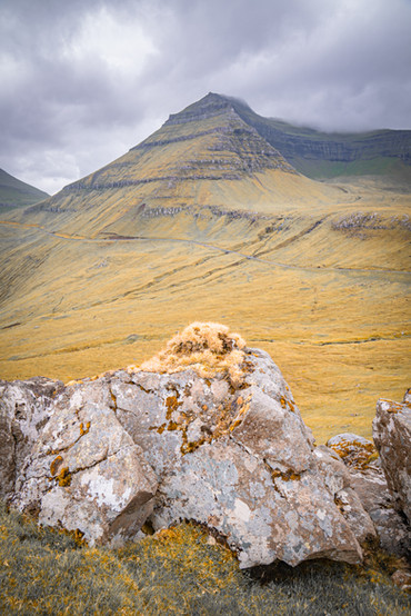
Hvíthamar is a mountain ridge near Gjógv that can be reached after a short and easy hike. From Hvíthamar, there is a great panoramic view of the Funningsfjørður fjord. The most captivating part of the view is the picture-perfect Húsafjall peak. You can park your car directly at the location I have provided below. The trailhead is clearly marked near the parking spot. Along the hiking path, you will notice green posts that can be used for navigating to the mountain ridge. Views over another storybook village Funningur can also be enjoyed during this hike.

Location on Google Maps: Hvithamar Trailhead
Funningur
A Faroese saga says that the first Viking on the Faroe Islands named Grímur Kamban settled in the pristine village of Funningur in around 825 AD. Funningur means ‘found land’. Just like in Gjógv, a lovely stream flows through Funningur. A traditional turf-roofed church in the village is worth a photoshoot.

Location on Google Maps: Funningur
Funningsfjørður
There are rewarding views of the fjord Funningsfjørður not only from the vantage point Hvíthamar we saw above but also from the roads that run on both sides of the fjord. The ridges along this fjord are exceptionally beautiful. A village of the same name as the fjord is located at the end of the fjord.

Location on Google Maps: Funningsfjørður
Eysturoy Image Gallery
Drop your comments and let me know what else you would like to know about the island. Pin it if you found this post helpful !


Related Posts
If you liked my article, then you might be interested in my other set of travel posts from the Faroe Islands.
WISHING MY READERS SAFE TRAVELS !


Comments